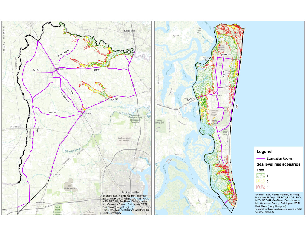
Nassau County residents were recently invited by the county’s Planning & Economic Opportunity Department to review data projecting the impact of flooding, storm surge, and sea-level rise on property, homes, and businesses. The News-Leader attended a Feb. 5 meeting on Amelia Island. Another...
Using data from National Oceanic and Atmospheric Administration, this map identifies those areas that are anticipated to be inundated by sea-level rise of 1, 3 and 6 feet. Areas close to the St. Marys River and the Intracoastal Waterway would the most impacted. As with storm surge, large portions of Amelia Island are impacted by the minimum 1-foot sea-level rise scenario predicted to occur by 2050, if not sooner. NASSAU COUNTY PLANNING & ECONOMIC OPPORTUNITY
Nassau County residents were recently invited by the county’s Planning & Economic Opportunity Department to review data projecting the impact of flooding, storm surge, and sea-level rise on proper…